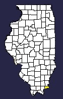


Hardin County came into being on March 2, 1839.
Before that time, residents within the modern county's boundaries lived in
Pope and Gallatin Counties. The dividing line between the two counties
started at Cave-in-Rock and ran northwesterly to a point two miles east of
the modern northwest corner of the county.
Gallatin County had organized first in 1812 and included all of Hardin. When
the territorial government organized Pope County out of Gallatin and Johnson
Counties four years later they chose the great cavern on the Ohio as a
reference point. They did so in part to keep the U.S. Saline Reservation all
in one county. This tract of land 12 miles wide and 10 miles from north to
south stretched between modern Eldorado and Ridgway, then south to the Eagle
Mountains (now Wildcat Hills). A tail, anywhere from one to three miles wide
stretched out from the southeast corner and followed the Saline River down
to its mouth on the Ohio River. The reservation set aside the land within
its boundaries for the use of the saltworks near Equality, the great
commercial endpoint for the early roads. Shawneetown, the river port,
developed where it did because it was the shortest point between the Ohio
River and the saltworks.
When the legislature created Hardin in 1839, the reservation for the
Gallatin Salines (as it was then called) still existed and apparently no one
intended to split it between multiple counties. At that point, Saline County
had not been formed and was still a part of Gallatin. The 1839 decision had
not been the first movement toward establishing a new county on the river
between Shawneetown and Golconda. Earlier residents of the area petitioned
the state to create Ohio County using generally the same boundaries, but
also including the southeasternmost township in what is now Saline and the
southwesternmost township in what is now Gallatin.
At first, Grand Pierre Creek (sometimes spelled Granpier) served as the
western boundary, but it was quickly changed to the straight north and south
line now presently used. That took place on Jan. 8, 1840.
By 1846, out-of-state competition had all but ended the economic powerhouse
of the Gallatin Salines. John Hart Crenshaw (of the Old Slave House fame)
operated the saltworks. Due to poor health Crenshaw turned over his business
to his son in late 1845. By 1846, the increased competition plus the drain
on the local workforce with the start of the Mexican War, led to Crenshaw
making a deal with the governor.
In the winter session of 1846-1847, the legislature made a deal with
Crenshaw: Give up the three years remaining in your 10-year lease and we'll
ignore the back payments you've not been able to make to the state. Both
sides agreed and the legislature then put the rest of the reservation lands
up for sale. Breakaway proponents throughout Gallatin County saw the move as
their time to strike. Residents in the western half of the county petitioned
for the new county of Saline. The Shawneetown business classes supported the
move as well because it would strengthen their effort to return the county
seat to Shawneetown. Residents in the southern portion saw their opportunity
to join with the 8-year-old county of Hardin. In quick succession the
legislature created Saline County (which led to a long-fought legal battle),
and on Feb. 20, 1847, authorized the removal of the southern part to Hardin.
This territory, long-called the "Curtail," then joined Hardin County.
Although formal platted settlements wouldn't come until decades later in
some cases, even by 1809, the basis for the communities of Cave-in-Rock,
Elizabethtown and Rosiclare could be seen in the formation of three militia
companies. Lewis Barker captained one company and he ran the ferry at
Cave-in-Rock. James McFarland ran the second and he had a ferry at
Elizabethtown. James Ford, though later associated with Ford's Ferry, Ky.,
upstream from Cave-in-Rock, captained the third company organized around
Rosiclare. Ford's father-in-law operated the first ferry there in 1799. The
trail from it to Kaskaskia, was known as the Miles Trace and part of it
served as the boundary between Gallatin and Johnson Counties at one time.
Ford later took over the ferry and ran a tavern and served as overseer of
the poor in the Rosiclare area prior to the War of 1812. The Sturdivant Fort
located above the current Rosiclare water tower probably dates back to this
period. When Gov. Edwards promoted Ford to major, James Steele became
captain for this company.
It is at this earliest time, even dating back to the late 18th Century, that
the foundations were laid for what Gov. Thomas Ford described as "an ancient
colony of horse-thieves, counterfeiters and robbers." Ford and Steele were
part of this colony. The outlaws of Cave-in-Rock are another part. The
Flathead and Regulator War that took place downstream in Pope and Massac
counties represented the aspect of the ancient colony that most troubled
Ford during his administration. For more on this ancient colony, visit the
Outlaws of Cave-in-Rock page at IllinoisHistory.com.
As far as towns go, Cave-in-Rock organized first as Rock and Cave post
office on March 13, 1832. The post office changed to Cave-in-Rock on Oct.
24, 1849. The village itself didn't incorporate until Jan. 7, 1901.
Elizabethtown established its post office on May 8, 1840 and incorporated on
Feb. 13, 1857. It is named for James McFarland's wife, Elizabeth.
Rosiclare didn't incorporate until April 19, 1932. Its post office history
started with the removal of Twitchell's Mill post office to the village and
its renaming to Rosiclare on March 13, 1844. It disbanded on May 7, 1852 and
was re-established two years later on May 24, 1854. Fort Harrison shows up
listed in a Shawneetown newspaper in 1840, by process of elimination it
could be a reference to Rosiclare and what was then left of the Sturdivant
Fort. The 1876 atlas shows Mineral City which is now a part of Rosiclare.
The town's name supposedly is from the names of two daughters of an early
settler, Rosa and Clare.
Further downriver from Rosiclare was Parkinson's Landing. A post office
under that named operated from July 11, 1867 to May 14, 1883 when it dropped
the landing and changed to simply Parkinson. Six months later on Nov. 7,
1883, it became Shetlerville and operated until Feb. 28, 1911. Peck
described this area as simply the Irish Settlement in 1837. Capt. Steele,
mentioned above, was one of the original settlers from Ireland.
Other small communities included Rock Creek, northwest of Cave-in-Rock. Home
of Anna (Pearce) Hobbs Bisgby, a post office operated there from Oct. 11,
1887 to June 1, 1914. Elizabethtown, the county seat, was settled by James
McFarland prior to the War of 1812 and named for his wife Elizabeth. It was
organized as village in 1840.
Other settlements were Battery Rock, Cadiz, Chambers Creek, Eichorn,
Ellisburg, Fairview Landing, Gross, Grosville, Hall Ridge, Hester, Hicks,
Illinois Furnace, Karbers Ridge, Lamb, Lambtown, McFarlan, Martha Furnace,
Monroe, Peters Creek, Robin's Ferry, Sellers, Sellers Landing, Sparks Hill,
Twitchell's Mills and Wolrab Mills.
Written and contributed by Jon Musgrave
| Saline | Gallatin | Union KY |
| Pope |
 |
|
| Livingston KY Crittenden KY | ||