


|
Hardin County ILGenWeb is a free genealogical site about the history of the county. We hope you find helpful clues for your research of ancestors and relatives of Hardin county.
Are you familiar with the area? Do you have a family tree connection to the area? Volunteers are always needed! Please consider contributing your pieces of Hardin County family history. Corrections, updates, and additions to this site are always welcome. Web sites go away and website addresses change. Please contact me. if you find a broken link on Hardin county web pages. I have recently taken over as County
Coordinator for Hardin County from Norma Hass. Thanks to
all the work she has done on this county. I am also County
Coordinator for other counties so please mention the county name
you are submitting information (or corrections) for in your
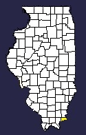
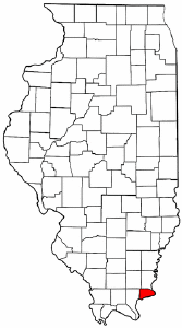
email to me. Thanks. County Coordinator: Sandy Bauer Corrections, updates, and additions to this site are always welcome. Web sites go away and website addresses change. Please contact me. if you find a broken link on Pope county web pages. I am also the County Coordinator for Jefferson (where I was born), Franklin, Marion, Clay, Pope and Wayne counties so if you want to contact me and/or contribute something, please mention the county so I won't post on the wrong county website.COUNTY FORMATION"After Illinois was admitted as a state in 1818, counties were laid out with more or less indefinite boundaries as this country had not as yet been surveyed. Pope and Gallatin counties had been organized but no definite boundary lines between the two had been fixed when the state legislature passed a bill on March 2, 1839, cutting off a portion of the eastern part of Pope County and called it Hardin County. This new county was in a form of a triangle — the Ohio river forming one side, Grand Pierre Creek one side, and a line, running in a northwesterly direction from a point on the Ohio river near Cave-in-Rock to the southwest corner of township 10, south range 8 east touching the southern boundary of the then Gallatin County near the head of Grand Pierre Creek, formed the other side. "By an act of legislature approved January 8, 1840, the western boundary was changed eastward to its present location and on February 20, 1847, territory was taken from Gallatin County, added to that already taken from Pope — giving Hardin County its present boundaries. Hardin County is in the southeast portion of the state of Illinois, is the second smallest county of the state and lies wholly within the Ozark territory — its northern boundary separating it from Gallatin and Saline runs almost exactly along the crest of the mountain range. "Note: The Shawnee Indians, a kindred tribe of the Tamaroas, actually lived in this county at the arrival of the white settlers." Extracted from History of Hardin County, Illinois, written 1939, by the Historical Committee for the Centennial |
| Saline | Gallatin | Union KY |
| Pope |  |
|
| Livingston KY Crittenden KY | ||


 Hardin County, IL has a population of
3,649 according to the 2020 census, making it the least populous
county in Illinois.
Hardin County, IL has a population of
3,649 according to the 2020 census, making it the least populous
county in Illinois.